Kula Volcanic Park
It is one of the most important volcanic forms formed in the third phase of Kula volcanism (Divlit Tepe Volcanics). In terms of formation and shape features, it is in the type of cinder cone or scour cone.

The Kurşunlu Valley
The Kurşunlu stream receives its water from the Kırkoluk springs originating from higher up Bozdağlar and the stream joins the Gediz River in the north of the Gediz Plain.
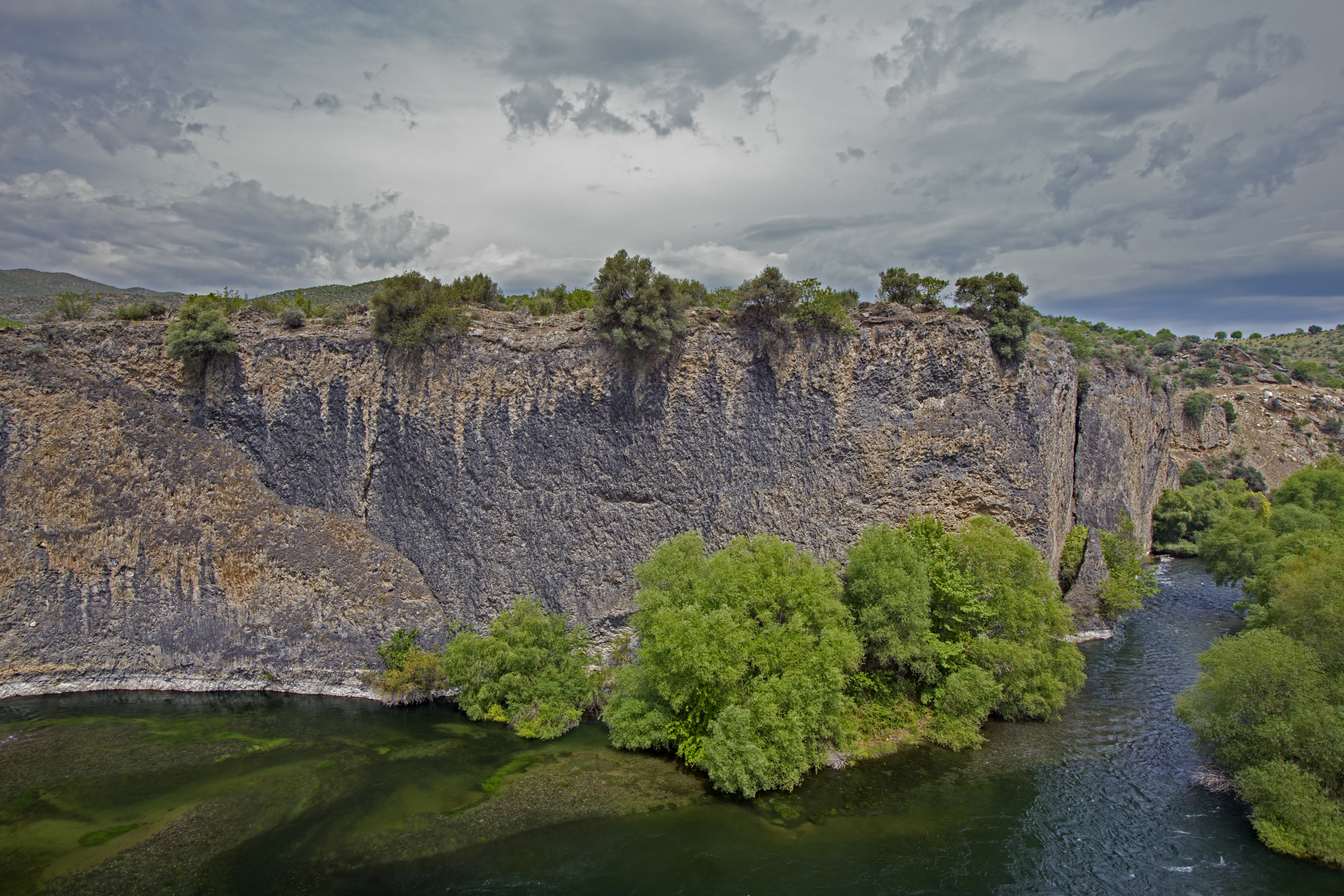
Adala Canyon
In the Kula - Salihli UNESCO Global Geopark, volcanic canyons with a total length of more than 20 kilometers were formed as a result of the fragmentation of the lava filling the valleys by the Gediz River and its tributaries. The most characteristic of these are the Evciler Canyon on Şöğütçayı and the Dereköy Canyon and Adala Canyon on the Gediz River.

Çakırca Basalt Columns
The volcanic rocks you see here were formed as a result of the spreading of the lava that emerged as a result of the activation of Toytepe Volcano, located at the northernmost end of the Sarnıç Plateau, approximately 1,260 million years ago.

Evciler Shist
Characteristic topographies have been developed on schists and gneisses, which are metamorphic crystalline rocks of the Paleozoic Menderes Massif, which form the bedrock of the Kula-Salihli Geopark.
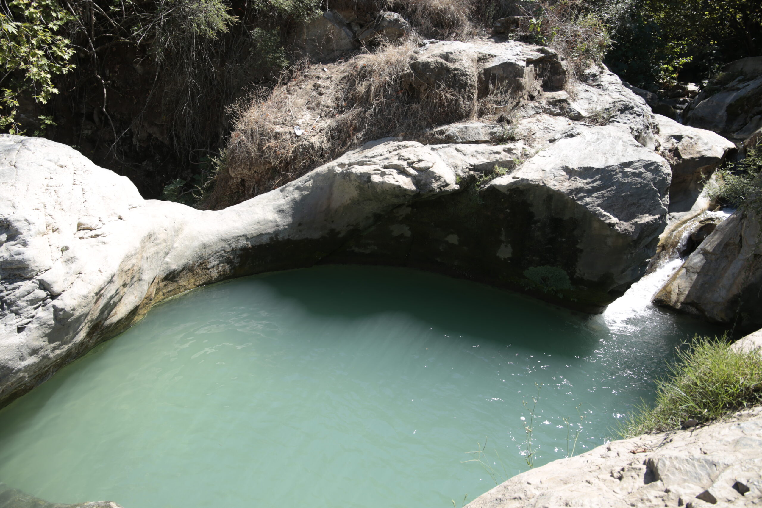
Tabak River Potholes
There are three potholes at different levels at the lower course of the Tabak River which has its source at the summits of Bozdağ Mountains. These potholes were formed at the knick point in the longitudinal profile of the river.

Kula Fairy Chimneys
In the Kula-Salihli UNESCO Global Geopark, the Fairy Chimneys were formed due to the joint effect of raindrop erosion, surface erosion and tunnel / piping developed within the soft layer.

Tmolos Deposits
Along the northern foot of the Bozdag Mountains there are fluvial fan deposits, which extend for approximately 110 kilometers in length.

Acısu Ophiolites
An ophiolite is a section of the Earth's oceanic crust and the underlying upper mantle that has been uplifted and exposed above sea level and often emplaced onto continental crustal rocks. Their significance relates to their occurrence within mountain belts such as the Alps and the Himalayas, where they document the existence of former ocean basins that have now been consumed by subduction.

Kurşunlu Waterfall and Current Travertine Formation
It is an artificial waterfall established by flowing the leaded stream over the sets established to regulate the flow of the Kurşunlu stream.

Marmara Lake
Marmara Lake which extends from 10 to 11 km from east to west and has a width of about 3 to 5 km covers an area of 56 km2 and is 79 m. above sea level.
Üfürük Geothermal Resource
The Üfürük Geothermal Area is located between the Mud (Çamur) Bath and Gökköy. Apart from other geotermal resource, In this area carbon dioxide and hydrogen sulphide gases get out.
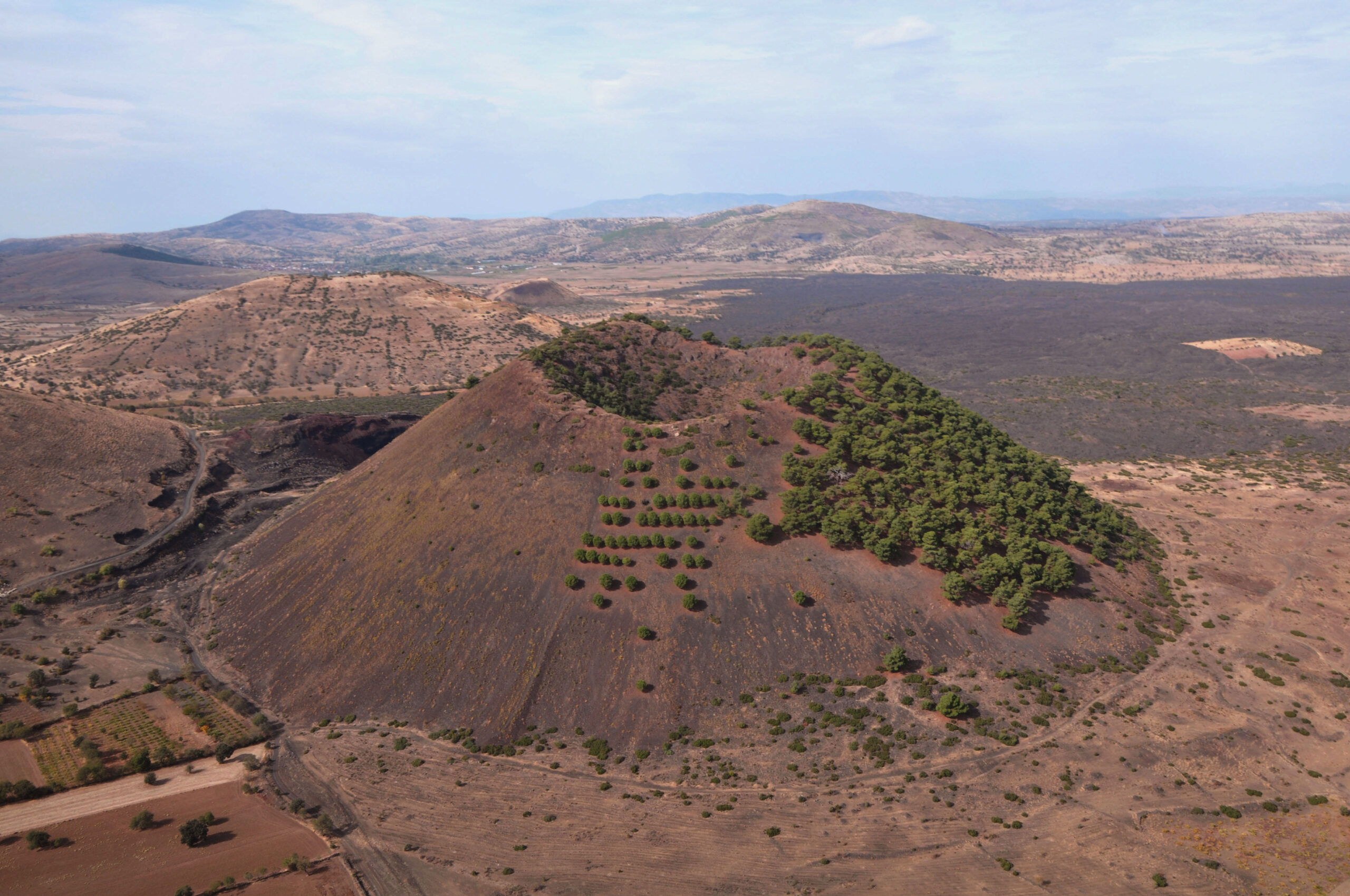
Sandal Divlit
It is one of the most important volcanic forms formed in the 3rd phase of the Kula Volcanism (Divlit Tepe Volcanics). In terms of formation and shape features, it is in the type of cinder cone or scoria cone.

The Gediz Graben
Western Anatolia forms one of the most seismically active and rapidly extending regions in the world. It is currently experiencing an approximately N- S continental extension, at a rate of 30-40 mm year. It forms a part of the “Aegean Extensional Province”, a region of distributed extension that covers parts of Greece, Macedonia, Bulgaria and Albania

Hydrothermal Alteration of Tmolos Deposits
The Tmolos deposits extend like a continuous belt along the northern slopes of the Bozdağ Mountains. These deposits are faulted and tilted, and some hydrothermal alteration can be observed due to the effect of the water along the faulted zones.
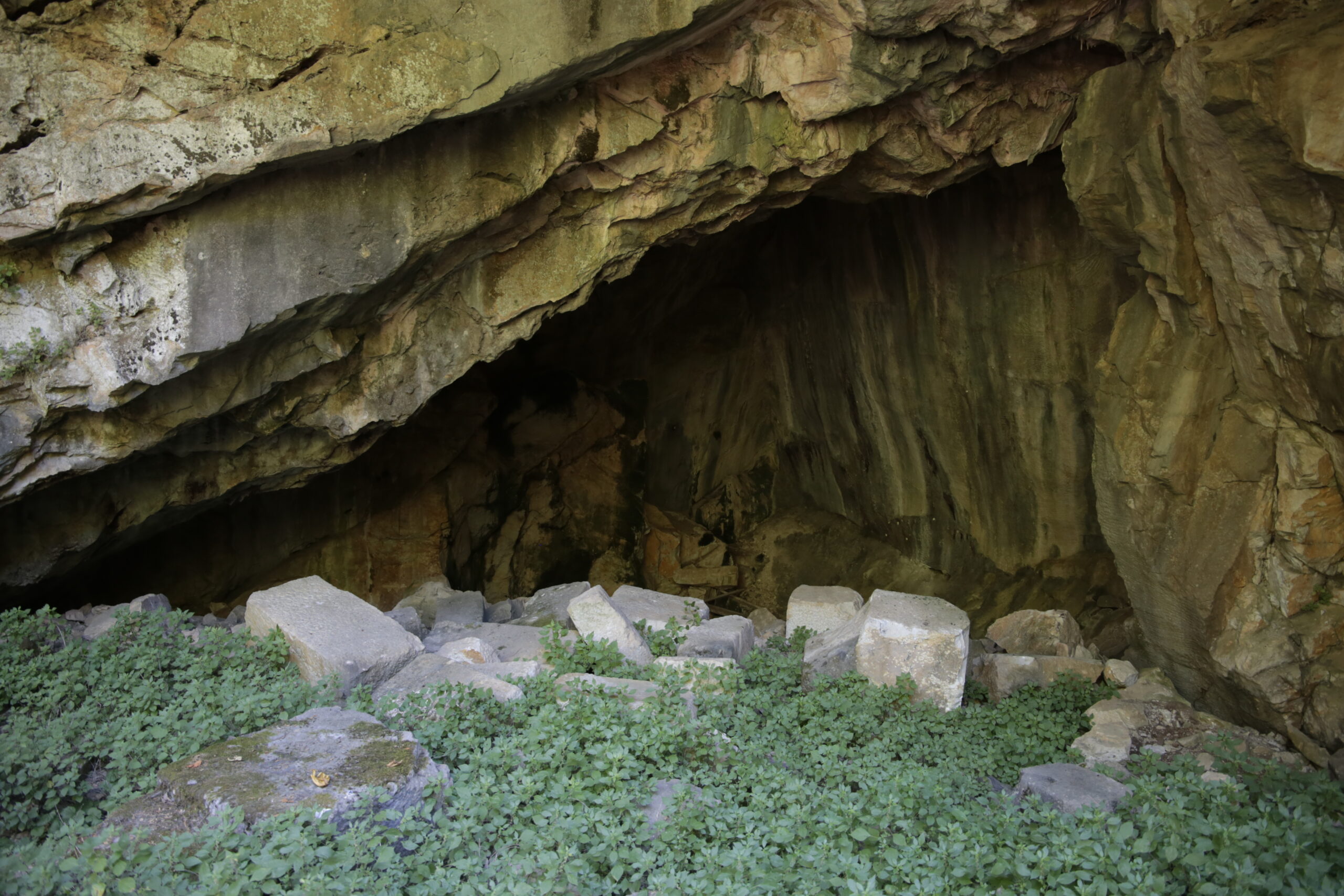
Kısık (Mağara) River Ancient Quarry
An ancient marble quarry is on the lower course of the Kısık River. This area is 3 km South of the ancient city of Sardis.